Left Indiantown marina with the sun (gee I hate that!) but we wanted to get across Lake Okeechobee early. Weather called for thunderstorms after noon......1200.....at three hours across the lake that forced an early departure if we wanted to cross today.....Indiantown Marina was cheap and a safe place to spend the night but for long term comfort it wasn't in the cards.
Back in the ditch and off to the lake. To enter the lake you have to pass through the Port Mayaca Lock. Just before the lock as you head west there is a railroad bridge. It is stored in the up position and to cross (if you're a train) the train has to come to a stop and the train crew has to manually lower the bridge. After looking both ways, of course. Through with no problemo, we called the Mayaca Lock. I knew the water levels were up in the lake, but I didn't expect the lock to be left open. It was. Just go on through, said the lockmaster. We did, and entered lake Okeechobee at 0915.
Lake Okeechobee is the second largest lake in the United States by size. Only one of the great lakes is totally within the boundaries of the USA. The others are shared with Canada. Even though it's a large body of water, they forgot to put much water in the water. Our journey was twenty five miles across. The first half was wide and open without much dangerous stuff. There was only one aid to navigation at about the 7 mile mark. It was relatively easy to find as I entered waypoints on the gps. Didn't make much difference here, but waypoints would be important from about mile fifteen to twenty five.
After the half way point, the lake bottom somehow turns rocky. They say it's okay to run into a mud bottom, but not a rock one. Go figure. Anyway, it just so happens that where the bottom turns to rock that the channel narrows and makes hard turns. Miss them at your peril. Hence the way points. Channel markers are nice, but they aren't close enough together for me, especially when it turns windy. You can easily be blown out of the channel if you aren't paying attention. As luck would have it the wind picked up and thunder heads were billowing. Looked like we were just going to make it.
We missed the rocks and made it through the swamp grass, arriving at Clewiston just before noon. That was enough for one day anyway, but we had a slip arranged for the weekend. As luck would have it, they have a tiki bar and some cold ones. They also have a bass fishing tournament going on. More on that later.
Back in the ditch......

The ditch on the chartplotter...... There were times it showed us driving on the land. Very reassuring.

Or, if you prefer knots......

Railroad bridge before Mayaca lock. You'll be wanting to know about this if you plan on sailing through......

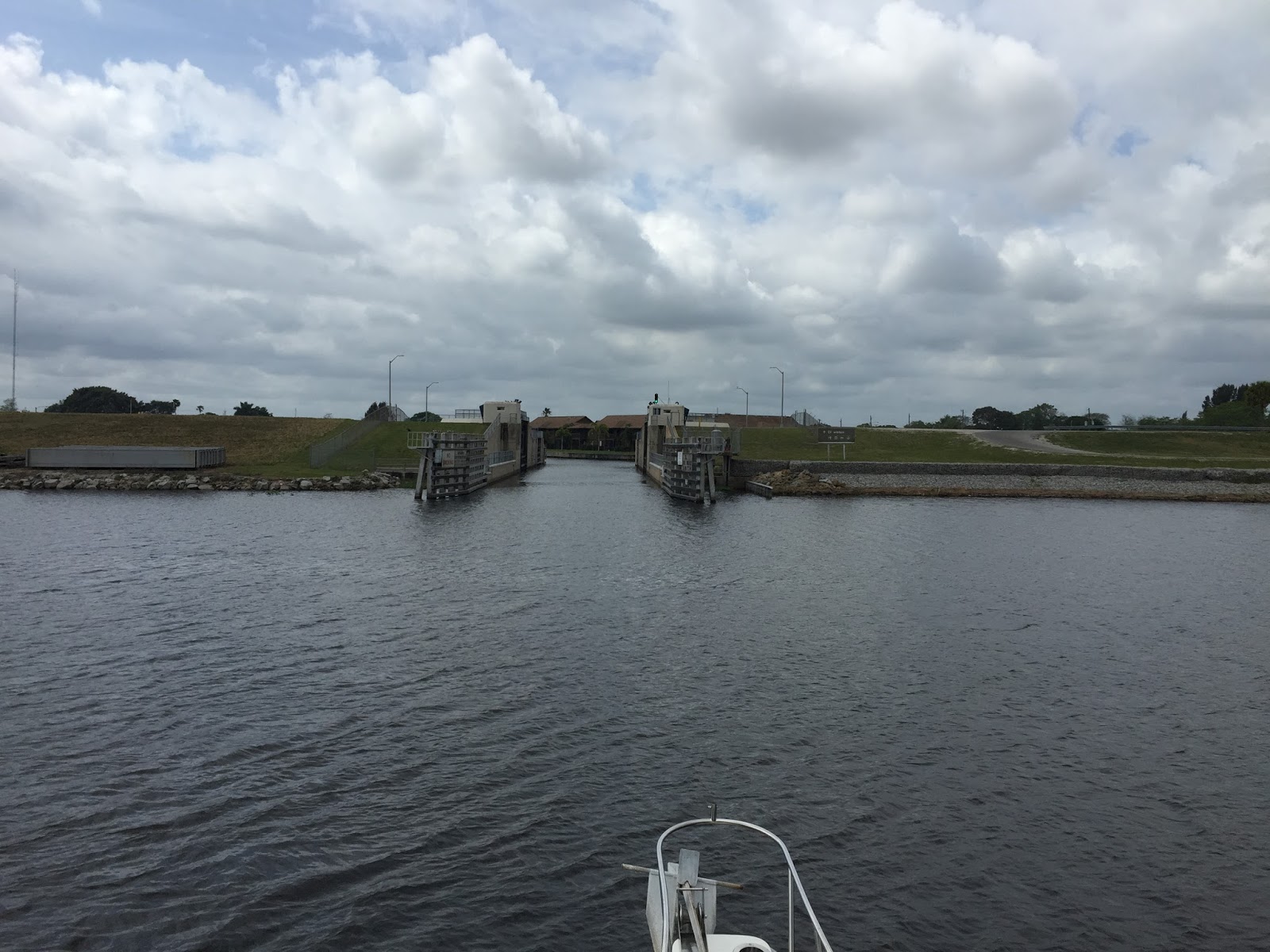
Port Mayaca Lock.....wide open. A good sign. Blue sky is a good sign too.....

I'm not sure if pelican poo is a good sign, but there was plenty of it!

Looking good so far.

The trick is to not hit the rocks and make your turns when you need to turn. Glad I learned how to set waypoints in Hawaii. Where the water was 3000 feet deep and you didn't need them anyway!

Channel getting narrow.....looks like it's gonna be important to stay in the channel here.

Here's a slightly larger scale.....

The Clewiston Lock....always open unless it's flooding.
'Merica.

No comments:
Post a Comment